Space-based VDES solutions for maritime communications and navigation
AOS, composed of AAC Clyde Space, ORBCOMM, and Saab, collaborates to venture into the domain of satellite-based VDES, exploring the next-generation of space-based VDES solutions for maritime communications and navigation.
As part of our collaboration, we deploy satellites into space to gather data for analysis and exploration purposes. In this ongoing process, we are actively constructing, launching, and commissioning the initial satellite in the project, Ymir-1. Scheduled for lift-off aboard SpaceX's Falcon-9 Transporter-9 carrier in November 2023, this marks the inception of a larger constellation of satellites, inaugurating a new chapter in maritime communication infrastructure.
Ymir-1 carries a VDES payload from Saab, enabling seamless two-way communication between the satellite and ground-based stations. AAC Clyde Space specializes in cost-efficient small-scale satellites, and ORBCOMM plays a pivotal role in integrating data into its distribution center for maritime communications service deployment.
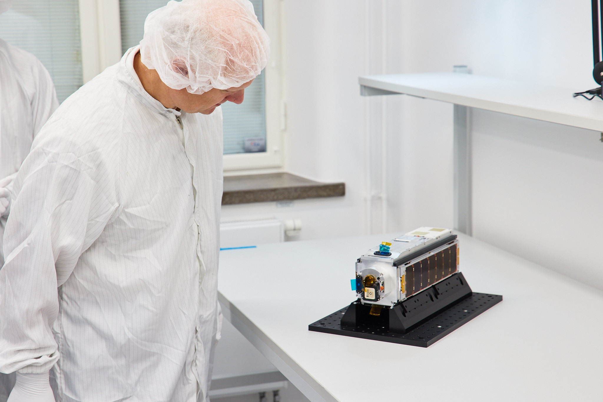
The Ymir-1 satellite serves as an in-orbit demonstrator with a specific mission - to provide essential data, laying the groundwork for data exploration and the development of VDES application services. AOS leverages this data to strategize the next phases of the AOS VDES Exploration Program, driving innovation and advancements in maritime communication technology.
Operating within the AOS testbed, our unique capabilities constitute a comprehensive skills platform, covering all aspects of satellite-based VDES communication, interfaces, and application services.
VDES APPLICATIONS BASED ON IALA G1117
The global adoption of VDES will revolutionize how vessels operate at sea, introducing a comprehensive array of applications that will have a profound and transformative impact on maritime operations. Below are some application services powered by VDES.
VDES, with its ability to provide real-time weather data and route recommendations, is set to redefine e-navigation and weather routing. Vessels will receive precise weather insights, enabling optimal route planning that minimizes risks posed by adverse conditions, reduces fuel consumption, and ultimately enhances maritime safety and efficiency.
VDES is a game-changer for maritime safety. It accelerates the exchange of critical information between vessels and shore-based authorities, significantly improving response times in Search and Rescue (SAR) operations. Distress signals can be swiftly transmitted and rescue efforts coordinated, potentially saving lives during emergencies.
The implementation of VDES facilitates efficient vessel traffic management by enabling seamless data flow between vessels and coastal authorities. Traffic monitoring, route optimization, and collision avoidance become more precise, ensuring safe navigation, particularly in congested waterways.
VDES empowers vessels to contribute to environmental monitoring efforts. It enables the real-time transmission of data regarding water quality, pollution levels, and weather conditions. This data is instrumental in assessing the environmental impact of maritime activities and responding proactively to environmental incidents.
Ports and harbors are set to benefit from VDES by streamlining logistics and cargo handling. Vessel arrivals, cargo statuses, and berth availability can be communicated in real-time, optimizing port operations, reducing turnaround times, and enhancing overall efficiency.
VDES supports sustainable fisheries management by monitoring and regulating fishing activities. It provides authorities with real-time information on vessel positions and activities, aiding in the combat against illegal, unreported, and unregulated (IUU) fishing practices.
In ice-covered regions, VDES proves invaluable for vessels navigating challenging conditions. It offers updated ice charts, icebreaker locations, and ice condition data, facilitating safe passage through icy waters.
The offshore industry, encompassing oil and gas exploration, wind energy, and aquaculture, benefits immensely from VDES. It enables efficient communication between offshore installations and support vessels, ensuring operational safety and productivity.
VDES plays a crucial role in hydrographic surveying by providing precise positioning and navigation data. This data is essential for creating detailed navigational charts and conducting underwater surveys for scientific and commercial purposes.
In essence, VDES is not merely an evolution but a revolution in maritime communication and navigation. Its multifaceted applications promise to enhance safety, environmental stewardship, operational efficiency, and global connectivity, positioning VDES as a transformative force in the maritime industry's future.